
Last update
UAS Geographical Zones
Important: The Geozones provided by the UAS manufacturers through the remote controller do NOT necessarily cover the restricted areas of Luxembourg territory. Also, there is NO automatic transfer of information between the UAS manufacturer and Geoportal. In all cases, only the UAS geographical zones shown on https://g-o.lu/uas are legally applicable.
Some areas can be dangerous if you operate a UAS there.
In order to address this risk, the DAC has - in collaboration with other entities - identified sensitive locations and the conditions necessary to guarantee the safety of operations. The locations we are speaking of are referred to as UAS geographic areas (or UAS areas).
Operators wishing to access an area will have to comply with all the conditions associated with it (for example: requirement of take-off authorization, pilot training obligation, obligation to notify the flight, etc.).
The text specifying the location and conditions of access to permanent UAS zones is the ministerial regulation of December 16, 2020. New ministerial regulations, introducing temporary UAS zones, their locations and conditions, are advertised in the news section.
For reasons of readability, the UAS geographic areas (permanent and temporary), together with their access conditions, are displayed on the dedicated tool Géoportail.
Where can I consult the UAS geographical zones?
The UAS geographical zones are displayed on the following map https://g-o.lu/uas.
Please note this map is dynamic and the existing zones may be activated several times a day whilst new or temporary zones (e.g. « Skoda Tour du Grand Duché », national holiday, etc.) are announced via the news section of the website.
All pilots and UAS operators are required to inform themselves on the access conditions before each flight in any given area.
The address uas.zones@av.etat.lu can also be used for any question related to UAS geographical areas.
What do the different UAS geographical zones indicate?
There is 3 types of UAS geographical zones:
- Prohibited: Are the zones which, by the conditions they contain, prohibit the UAS flights. This is typically the case with football stadiums, local airfield such as Useldange and Noertrange and special events (Skoda Tour, national holiday…)
- Require an authorization: Are the zones which, by the conditions they contain, require prior authorization for UAS flights. This is typically the case with the penitentiaries center (e.g. Uerschterhaff, Givenich), Findel Airport, Palais Grand-Ducal Luxembourg
- Conditional: Are the zones which, by the conditions they contain, require prior notification for UAS flights. This is typically the case with Helistations, Findel Airport…
UAS GEOGRAPHICAL ZONES for UAS with class mark “C”
The UAS geographical zones are directly extracted from the geoportal in a .JSON file format, using the following link https://drones.geoportail.lu/zones. This .JSON file shall be upload into the UAS with class mark C1/C2/C3 or any other UAS that might be equipped with a geo-awareness system.

It is essential to repeat this process before each flight to guarantee that the geo-awareness system is operating with the most up-to-date information.
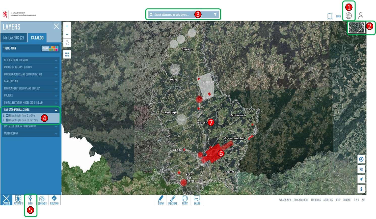
How to use the GEOPORTAIL?
A quick user guide is available in English and French and it provides a very quick overview of the operation of the dedicated map.
-
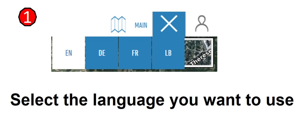
image-1-how-to-use.jpg
-
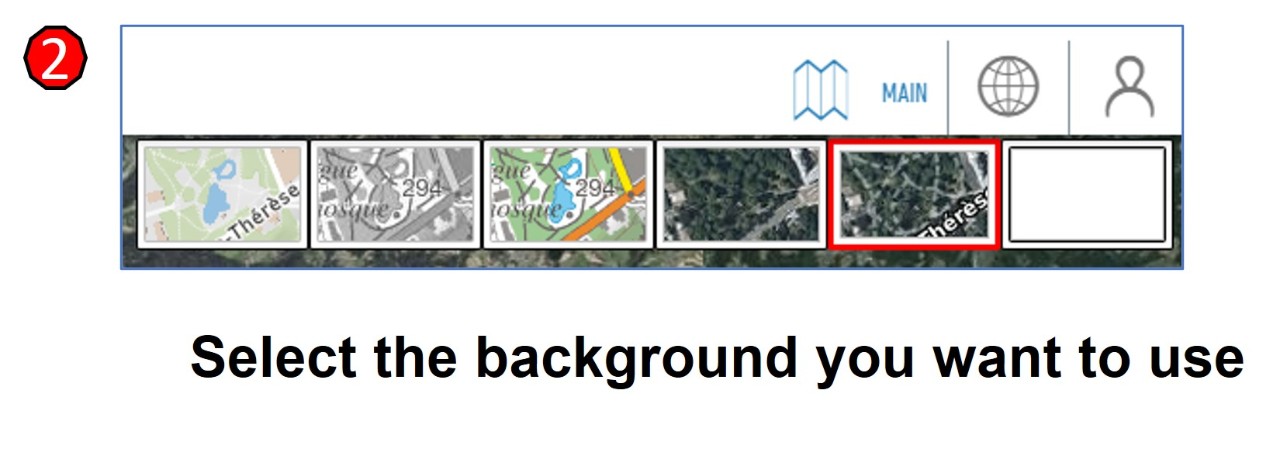
image-2-how-to-use.jpg
-
image-3-how-to-use.jpg
-
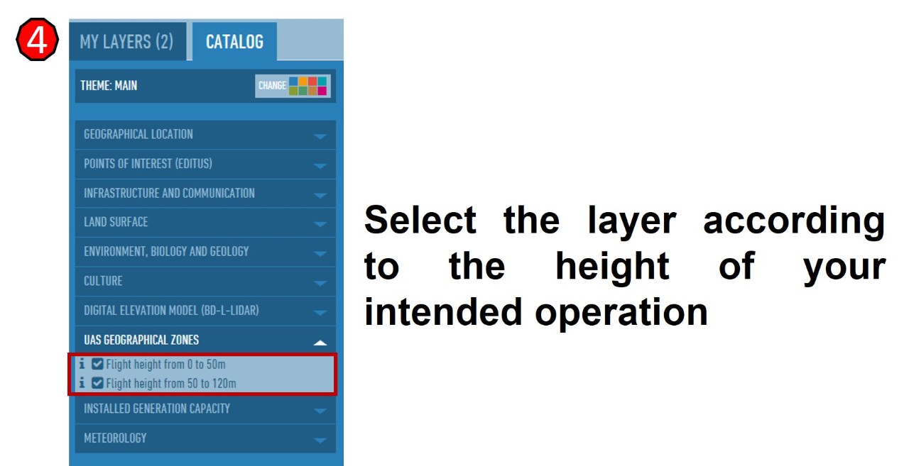
image-4-how-to-use.jpg
-
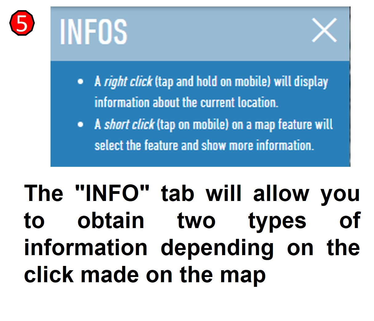
image-5-how-to-use.jpg
-
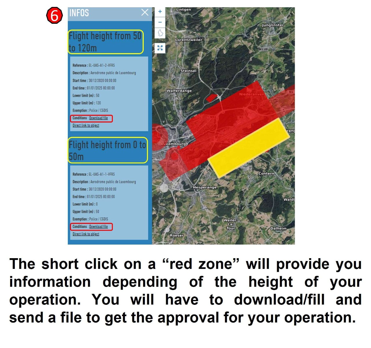
image-6-how-to-use.jpg
-
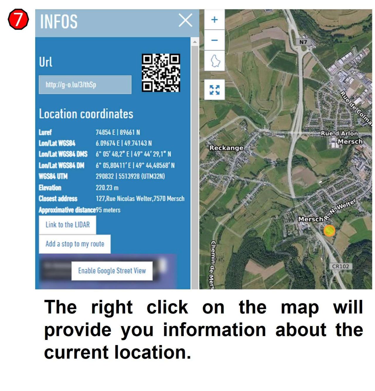
image-7-how-to-use.jpg